Digital Risk Infrastructure Program Strengthens Texas Communities
January 25, 2024
Tweet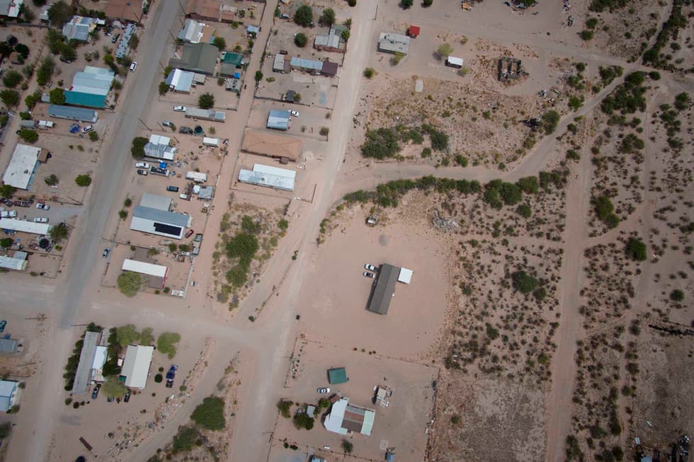
By Taylor Bounds, Division of Marketing and Communications
With a lofty goal and the support of the Texas Legislature, the Texas A&M Institute for a Disaster Resilient Texas (IDRT) launched an initiative called the Digital Risk Infrastructure Program (DRIP) in 2022 to provide under-resourced Texas communities that experience chronic and acute flood events with better tools and training to help local leadership reduce future losses.
"DRIP is so important because the goal is to empower under-resourced Texas communities with digital tools and training to make informed disaster mitigation decisions, secure funding, and reduce future losses," said Dr. Sam Brody, IDRT director and professor in the Department of Marine and Coastal Environmental Science. "We bring to bear the highest level of data analytics to low-capacity communities so that we can help them better understand and mitigate their disaster losses over the long term."
DRIP worked with ten communities across six regions of Texas, identifying and rectifying an immediate need for flood risk data in each. Two counties, Wise and Hudspeth, worked with DRIP on projects tailor-made for each locality.
At its core, DRIP is a community-based project that works with residents and local leadership to meet common goals. The DRIP team traveled across the state and held over forty meetings with county and city officials and staff about their flood data challenges and needs. Including even door-to-door data collection, the DRIP team designed the flood mitigation program at the grassroots level.
Nick Diaz '18 '20, a marine and coastal management and science doctoral candidate, said, "Most communities and counties impacted by recurrent flooding events not only need a physical, tangible flood risk map, but also a figurative vision map and flood defense strategy for the policies and funding opportunities, to ultimately implement real change."
In Wise County, a rural community in the far northwest corner of the Dallas-Fort Worth Metroplex, DRIP provided county officials with the needed high-resolution flood hazard maps. As the county experiences unprecedented population growth, the natural environment is replaced by a built one and the physical landscape changes.
By creating both interactive and print maps, DRIP's final product for the county visualizes flood depth surface elevation and can show the impact of 10-, 25-, 50-, 100- and 500-year storms. These maps help ease uncertainty about the usability of existing data and allow county administrators to make more informed decisions on policy and planning.
Over 500 miles away in Fort Hancock, flash floods plague the small Hudspeth County farming community situated in a valley on the Texas-Mexico border. When the town floods, arroyos, dry watercourses that fill with water during rainfall, create dangerously fast-moving water. Flash floods in Hudspeth County can happen with as little as three-tenths of an inch of rain, washing out bridges and roads, trapping people in their homes, carrying debris, and destroying everything in the water's path. As residents try to protect their property from flooding with makeshift embankments, it causes the floodwaters to create new paths of destruction, and the problem continues.
"Many people don't know where an arroyo is, so it's much cheaper for people to build in these arroyos, not knowing that it's not a matter of 'if' but 'when' it's going to flood," said Hudspeth County Judge Joanna MacKenzie.
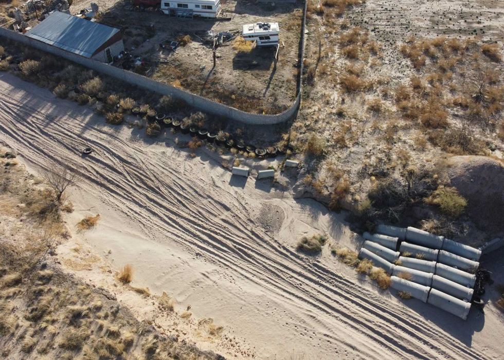
Fort Hancock had nearly no traditional flood data sources, disqualifying local officials from participating in state, federal and private flood prevention programs that could potentially help the town prevent future disasters. Through collaboration with local residents, DRIP collected photographs and accounts of flooding as an approach to the lack of flood data in the area. By explicitly addressing the data desert, the flood data visualization provided by DRIP puts Fort Hancock on the literal map for flood risk analysis, allowing local officials like MacKenzie to put policies in place and apply for programs that will ease the burden of flooding in Fort Hancock.
In a massive collaborative effort, the DRIP team included several partners outside of Texas A&M.
"DRIP was an amazing opportunity to build a program from the ground up, working collaboratively with local communities," said Katharine Telecki, whose consulting firm served as the project manager for the two-year grant.
"Residents of Hudspeth County said they felt heard and understood through our project. That was extremely rewarding," Telecki continued. "It was an honor to work with these community leaders who are so dedicated to their communities. A relatively small investment in a program like DRIP can make a huge difference."
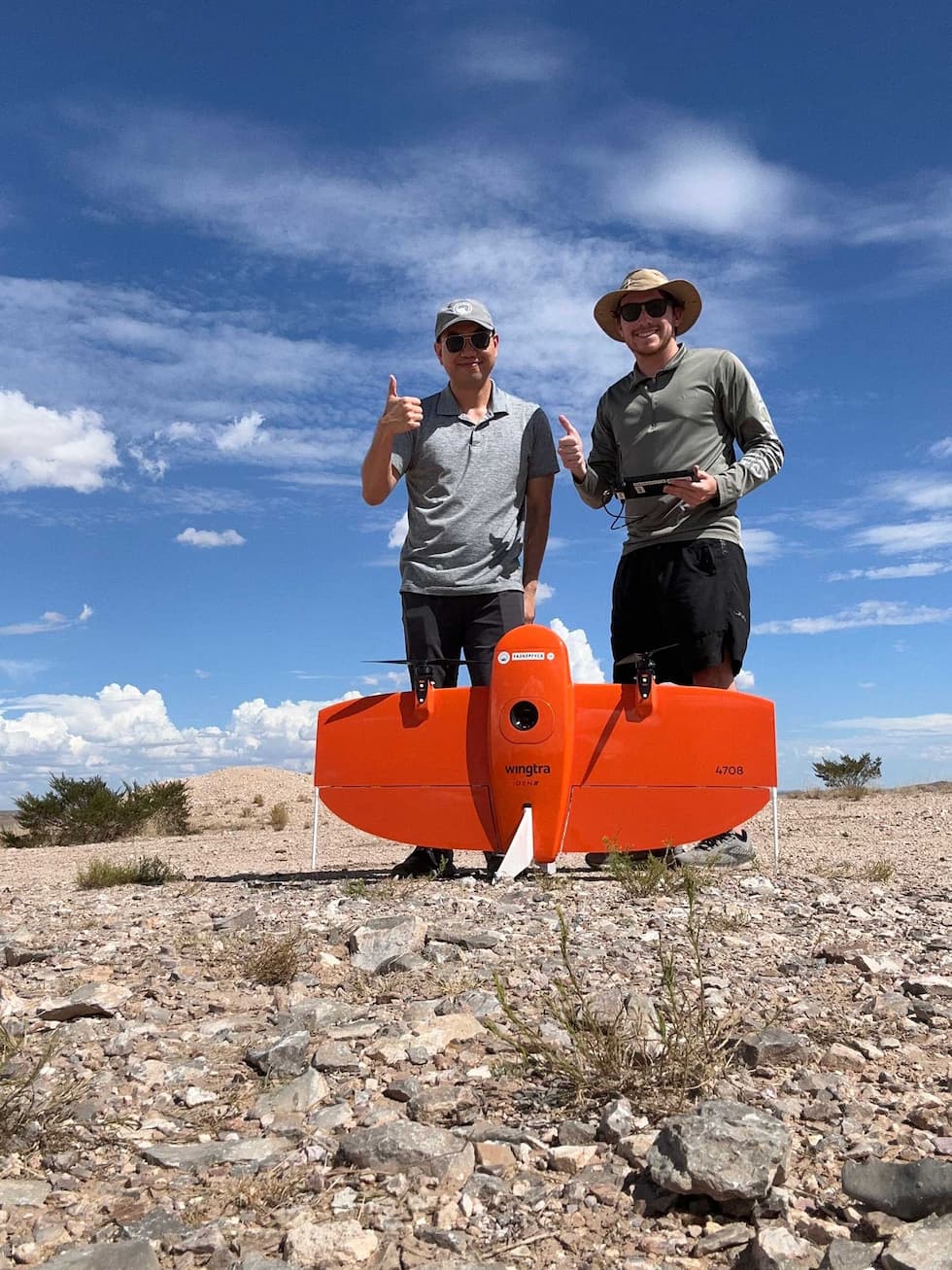
When Nick Diaz joined the project as a graduate assistant researcher, he was initially charged with gathering any available flood risk data and presenting it to the participating counties. Diaz soon transitioned into the project's drone pilot, surveying areas at risk of flooding. As he traveled through the counties, he saw issues that were personal to him firsthand.
"DRIP is especially important to me for many reasons, but mostly because I, too, am a Texan who grew up in a small town north of Austin that experiences flooding," said Diaz. "Seeing the flood risk and impacts to the participating DRIP counties relates to me as I see the same development patterns occurring in my town. Spreading the word surrounding flood risk awareness is never too much and is often too little, so it was a great feeling to be a part of this initiative."
MacKenzie also stressed the importance of DRIP in partner communities. Emphasizing the significant impact that flood mitigation will have in Hudspeth County, she said, "DRIP's program is not just life-changing, this will change generations in this community."
--
DRIP's partners include Texas A&M AgriLife Extension, Telecki Consulting LLC, Texas Disaster Information System and the University of Texas. At the legislative level, State Representative Armando Walle authored House Bill 2345, creating IDRT and forging a pathway for DRIP. Walle was also fundamental in securing funding for the first two years of the project.
DRIP, in collaboration with partner communities, is seeking additional funding to continue the program. If you are interested in becoming a partner, please contact Katharine Telecki.
###
Media contact:bounds@tamu.edu